Mobility
Creating a walkable, bikeable life where everyone can safely and pleasantly walk, bike, trike, use a golf cart, and access great transit allows for housing without parking – a key tool in creating an abundance of homes that are affordable to workers and moderate and low income households.


Cars take up too much space physically to work as a form of mass transportation in a city; there will always be traffic. Cars work well in exurb and rural areas, and along stroads with big box stores and massive parking lots. But there is literally not enough space on roads to accommodate the demand: case in point, every street on the Westside of Los Angeles is over capacity for cars every day during peak hours, according to the Los Angeles Department of Transportation. There’s simply not enough space on the roads, and we know empirically that due to Induced Demand, if we widen the streets we just get more traffic.
We need to reduce the number of car trips, which is also critically important to our climate goals, as well as for the toxic tire dust in the air. And to do that we must give people alternatives they will use.
The key to creating mobility people will use is understanding that it is an on/off switch: if it’s safe, pleasant, and reliable, the majority of people will opt in. If it’s unsafe, unpleasant and/or unreliable, very few (1%-10%) will use it. For instance, the data shows only 1% of people will use a scary bike lane – and bike lanes in LA and across the US hover at around 1%. But if biking is safe, we know over 80% of people will bike.
How Mobility Works
1.

In that sense, there is no medium-quality mobility – there’s high-quality which is broadly used; or it’s problematic, and very few people use it.
What makes it high-quality? Great mobility is a matter of design and engineering: subways in Tokyo, biking in Bogota, the walkable inner core of Vienna. All of these models scale in any city that replicates the design and engineering – it’s “off-the-shelf” tech.
How do we replicate high-quality mobility in LA? The three legs of the stool of mobility are walking, transit, and bikes – and they all have different requirements and ingredients that make them high-quality.
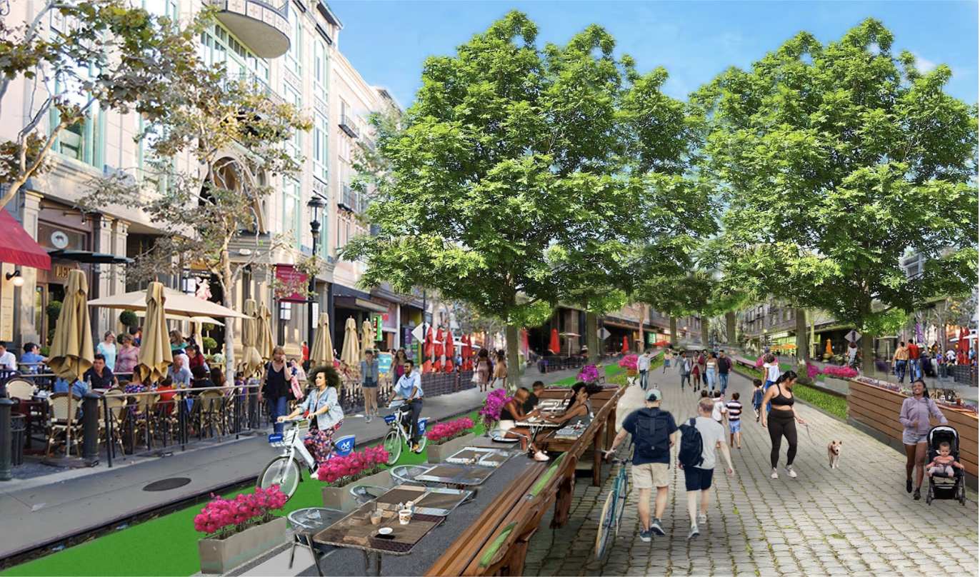
What makes a street walkable? People are drawn to certain streets to stroll, shop and linger – especially where there are lots of shops and lots of other people.
There are three main ingredients to a walkable street.
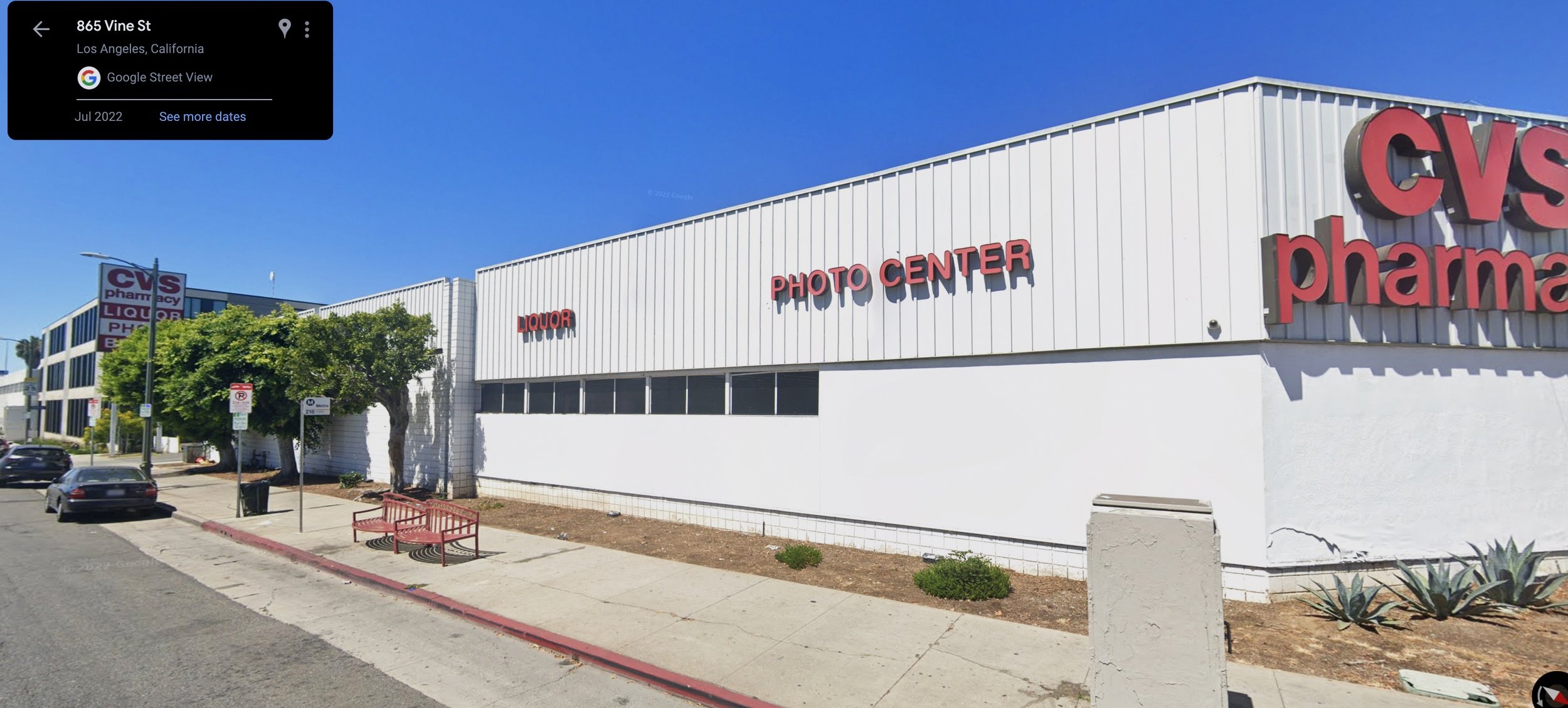
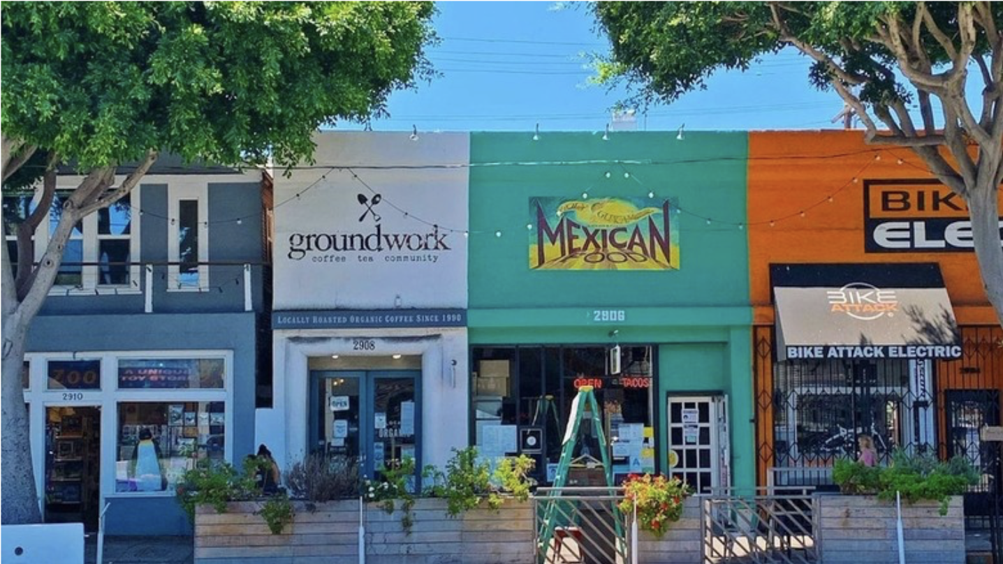
Number one is Neighborhood Serving Retail. These are small storefronts (25-30 feet wide) with local shops that serve daily and weekly uses – restaurants and coffee shops, grocery store, mail shop, pharmacy, bookstore, bakery, bank, hardware store, general store, nail salon, butcher, local bar, and small retail (clothing, home goods, picture framing, etc.) It’s not a big box store with a dead frontage, curb cuts/driveways, surface parking, ground floor commercial office space with the windows blacked out, or self-storage units – these all deadend a street.
The second main ingredient is trees. Trees provide shade and dappled sunlight, making it pleasant to linger and stroll. Greenery also changes the chemistry of our brains and makes us happier.
The third main ingredient is slow cars or no cars. In order for people to feel relaxed and enjoy walking, they need to feel safe from speeding cars. Slowing the cars, and making sure there are not too many of them, transforms a street overnight. A pedestrianized “no car”street is often ideal.
Neighborhood Serving Retail: Small local shops activate a street and provide a multitude of options for errands. Family owned legacy businesses add to the history and sense of community. Most blocks in LA have 15-20 storefronts – so a resident can turn right and get to 30 stores, and left to get to 30 stores with a one block walk. When local stores add awnings, cafe tables and al fresco dining it makes the street even more vibrant and visually pleasing. A vibrant block full of people creates “eyes on the street” – so people are actually safer.
Walking
2.
Trees: The second key ingredient is a tree canopy to create shade and because greenery and nature calms us and makes us happier – it draws people to the street. Umbrellas also add shade and liven up a street. Other elements that the city can add to create what Jane Jacobs calls a “sticky street”: street furniture like benches and adirondack chairs; parklets; and public art.

Rotterdam, Netherlands

Poznan, Poland

Las Ramblas, Barcelona
Slow cars: The third ingredient is slow cars and not too many of them. When cars are moving under 15 mph people can walk across the street with minimal stress. Pedestrianized streets are the calmest and most inviting. Fast cars whizzing by on a street with nine lanes of traffic is scary, stressful, noisy and polluted – and people don’t tend to stroll and linger. With no cars, kids can wander more freely, and have the independence to walk to the store and pick up milk, or meet a friend and explore.

How do we create walkable streets in LA?
The easiest way is to start with a street that is already walkable. LA has hundreds of neighborhoods with fine grain retail – particularly our Historic Main Streets and Villages. LA was a city of 400 neighborhoods connected by trolleys and bikes (and later, by cars). They still exist – Downtown Culver City, Main Street in Santa Monica, Leimert Park – and they have small local shops and restaurants and Neighborhood Serving Retail (NSR) – giving the neighborhood a small town feel that draws in pedestrians to stroll, sit, and shop.

Almost any street with fine grain retail has the bones for an LCI, as long as the cars can be slowed. An LCI can start with a combination of NSR along a slow-car street like Westwood Village or San Fernando in Downtown Burbank which has one lane of one-way traffic. An even easier option is to start with a pedestrianized street like Third Street Promenade in Santa Monica. It is also possible to identify streets where it makes sense to slow cars. Options include a dead-end street: Westwood Blvd is 1.5 miles and dead-ends at both ends. Or a street that carries very little traffic in the first place: Hollywood Blvd is both a dead-end street and is nestled at the base of the Hollywood Hills and traffic has dissipated by then. These streets don’t carry significant traffic, as opposed to being an artery through the city like Wilshire, Venice and Olympic – which are necessary to getting cars through the system.
With slow cars and existing storefronts, the street can be reimagined with trees, al fresco, carts, street furniture, etc. Housing above stores creates built-in customers. All the parking spots can remain to support the local retail (and re-thought over time).
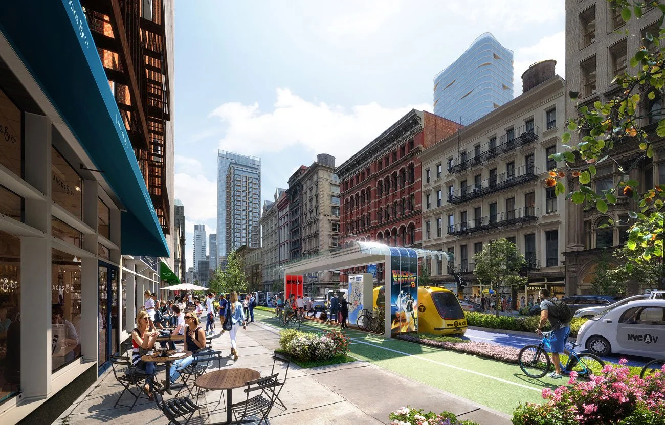
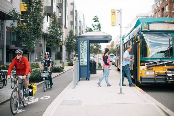
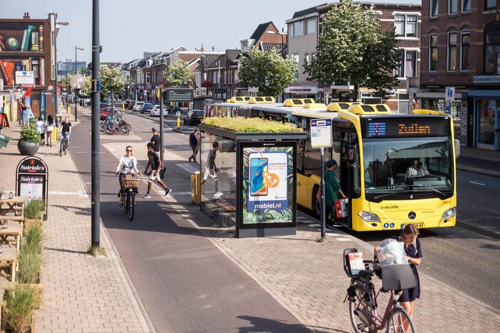
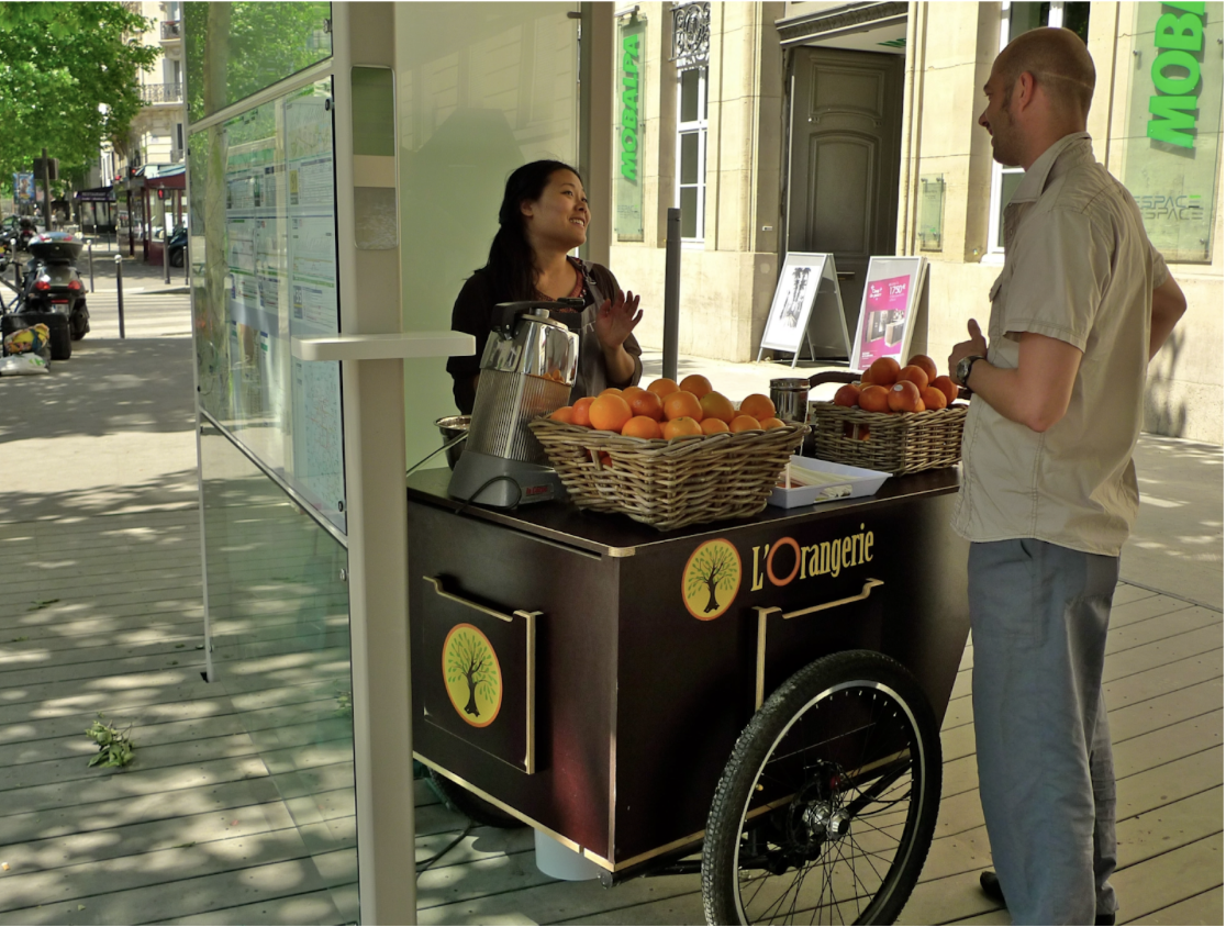
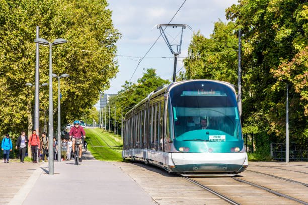
Transit comes in several forms: buses, light rail, subways, trolleys, trams and heavy rail (trains). High-quality transit needs to be safe, pleasant, and reliable. Reliable means it needs to be fast and frequent – come every 15 minutes and be on time; or come every 2-8 minutes, so people always know they won't wait for an uncomfortably long time, especially without bus shelters. Bus shelters that block the sun and warm people when it’s cold and comfortable seating increase ridership, and shows respect for bus riders. Other things that help the experience: real-time information on arrival times (Apps or LED displays), all-door boarding to reduce travel times, low or no fares, and newsstands and coffee carts adjacent to bus shelters (more information on bus shelters.)
Transit
3.
Seattle
Utrecht, The Nederlands
Strasbourg, France
People also need to be able to get to transit. For that, they need a seamless connection that is safe and pleasant – a pleasant walk or a safe and calming bike ride. Data from Dutch researchers shows that people will walk and bike much further to get to a transit stop if it’s pleasant and safe. In this way, the qualitative affects the quantitative.
LA already has high-quality transit: LA Metro has world-class transit infrastructure, but needs ridership (which has created serious safety issues). Empirically, the core problem is that people can’t get to the Metro: we are missing the “first mile-last mile” connection. What is essential is that the connection has to be a seamless path to a Metro stop. A walkable street, slow car, activated street that directly touches a Metro stop can create that seamless connection.
Then that walkable street can become an LCI – instantly creating a Transit-Oriented Development (TOD). Instead of a traditional TOD – a circle around a high quality transit stop, the LCI is a spoke – a linear TOD. Housing on this LCI can be developed anywhere along the street because the entire street is safe and pleasant to walk along, and is a seamless path to get to the Metro stop.

The traditional TOD circle around a transit stop can be a challenge in parts of Los Angeles. If housing is half of a mile away (only a 10 minute walk), if it requires crossing a street with eleven lanes of speeding cars, or walking past empty parking lots, warehouses, car dealerships along a street without shade cover, it might be so low-quality people will opt out and drive. This is why so many transit-oriented developments in Los Angeles still have on-site parking – because residents still want to own a car – and/or Developers believe they want to. In this case, the decision to include on-site parking actually drives car-ownership (while the opposite is true: if a building has no parking, people statistically ditch their cars).
An LCI solves this dilemma because it creates a parking-free community of car-free residents – and there is a city-wide, bureaucracy-wide commitment to high-quality walkability along an LCI – creating built-in ridership for the Metro.
And another proven – way to expand access to the Transit stop is through high-quality bike infrastructure.
People love to bike. It is our happiest form of transportation. It’s meditative, fun, convenient, great exercise and free. When biking is safe (such as on a car-free college campus or along the Venice bike path), 80% of people will bike.
Bikes also scale up transit – it solves the first/mile last mile problem in a much bigger way than walking: a 15 minute walk is ¾ mile, but a 15 minute e-bike ride is 7 miles. Bikes expand our world.
Bikes
4.


Bikes also complete the picture of mobility because they can replace car trips in a way that walking and transit can’t: cargo bikes can carry bigger loads and a weekly grocery run, and bikes and trikes can have a basket for smaller errands – a quick trip to the corner grocery store for supplies for dinner. Cargo bikes are used all over the world for getting young kids to preschool. And when schools are too far to walk, and there isn’t a direct bus, parents and kids can ride bikes together. Bikes also give teens and tweens far more freedom to roam and explore; 10 year olds can bike on their own in the Netherlands – to school, a friend’s house, and activities.
But scaling up biking has been elusive for cities, especially in the US where bike mode share (the percentage of trips that are by bike) hovers around 1%. But the good news is that a few countries have cracked the code, especially the Netherlands (considered the bike capital of the world in terms of engineering and design.) The Dutch are unique in that they both study bike infrastructure, and put it into practice – and have replicated their best practices in every city in the country – Amsterdam, Rotterdam, Utrecht – pre-war cities, post-war cities and Medieval cities. By following their engineering and design rules, cities like Boulder, CO, Copenhagen, and Paris have replicated their success.
There are several factors to scale up biking from 1% to Dutch cities where 80% of people bike and 30-50% of trips are by bike (the most popular form of transportation in some cities). There needs to be connectivity of the network and the bike lanes need to go places people want to go. For example, the perfect bike lane that ends after one mile or a bike lane to nowhere does not get much usage.
The other essential ingredient is safety. Safety is an on-off switch for people. People have different levels of risk-aversion – from highly risk-tolerant to highly risk-averse (and there are also people who love adrenaline). These different states of mind show up in mode share: there is a leap from 1% to 8% to 80%, correlated to the safety of the bike infrastructure. Unsafe lanes = 1%. Good to great quality bike infrastructure can get to 8% (separated bike lanes, highly-engineered intersections). When it’s child-safe – like a college campus or a car-free neighborhood or the Venice bike lane along the beach – 80% of people will bike (90% of the residents of the Dutch city of Utrecht bike).
What determines safety? Safety is determined by the speed of the car. Fast speeds diminish the field of vision, and drivers have less time to stop and avoid an accident altogether.
But the greatest issue with speed is the physics – force is a factor of mass (weight) and acceleration / speed – and it becomes exponentially more deadly the faster a car is going:
9mph - the Dutch consider safe for children
<18mph - the majority of people survive
20mph – 10% chance of dying
30mph – 50% chance of dying
40mph – 90% chance of dying

The key number is under 18 mph (30 km/hour): that is the speed at which there are almost no fatalities – the difference between life and death.
Bike lanes are like any infrastructure – the design and engineering determines their safety. Freeways have strict rules around the slope and banking, and they are built to precision so drivers don’t flip their cars as they drive around a curve in the road. We engineer bridges to never collapse and airplanes to never crash. And the Dutch engineer their bike lanes to protect every cyclist, especially children and seniors. The bike lanes are so safe that almost no one wears a helmet (without advocating for people not wearing helmets, we know it’s safe when no one wears them.)
The best way to create bike infrastructure is to ensure that when a car interacts with a person, it is going at a safe speed – definitely under 18 mph, and safest is under 9 mph. This can be done through separated bike lanes (parking, metal bollards, or a curb). When a bike lane is protected, there are almost no accidents – except at intersections. Intersections need to be highly-engineered so cars see themselves as “guests” as they cross the path of a bike or pedestrian. There are several strategies that have been shown to work: force the car to make a sharp turn so they slow down or risk flipping their car. Cars need to drive up on a speed table which signals to drivers to slow down and be careful. Having two sets of stop lights – one for cars, and one for bikes – allows bikes to go first and forces cars to wait, minimizing interactions.
But the easiest and most surefire way to create a bikeable city is for bike riders to never interact with a car. If we bring empathy and compassion to the debate about “how safe do we want bike lanes for children” and we ask ourselves – “how fast do we want a car going when it hits someone – a child, a parent, an elder, someone we know? 20mph, or 9mph?” The answer is almost always: “0 mph.” We don’t want children, or anyone, to be hit by a car.
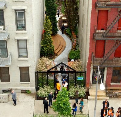
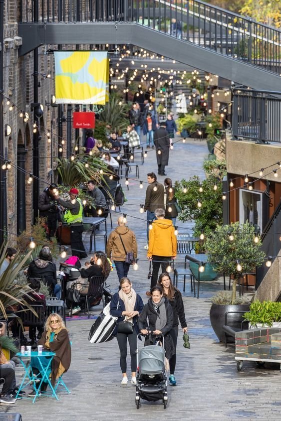
The Case for Pedestrianization
5.
Pedestrianized streets can be magical. A car-free street with small shops, trees, street furniture, coffee carts and al fresco dining invites people to stroll, linger and shop. This in turn helps businesses thrive.
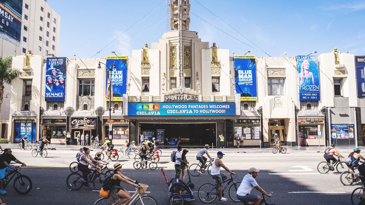
Can we do it in LA? We close streets temporarily all the time across Los Angeles; for movie premieres, Farmers Markets, events and CicLAVia. Many streets only carry minimal traffic – dead-end streets, out of the way streets, and streets parallel to a freeway – so closing them has a negligible effect on traffic.
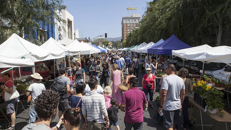
One way to build support and test the idea is to close the street for one Saturday or Sunday to pilot it, and then pilot it every Saturday for a few weeks or a few months. These temporary pilots can bring the community along and give people time to consider the changes and if they work for them.
Cities all over the world pedestrianize streets and create Promenades – a walking path lined with trees, park benches, coffee carts. It is simple, cheap and quick: it can happen almost overnight – just remove the cars. Temporary materials like planter boxes, potted trees, paint on the ground, and movable furniture like picnic tables can be iterated and changed to find the best design that works for the community.
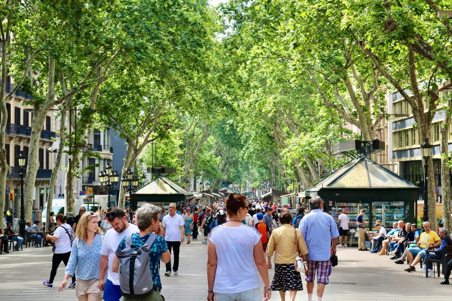
Las Ramblas, Barcelona
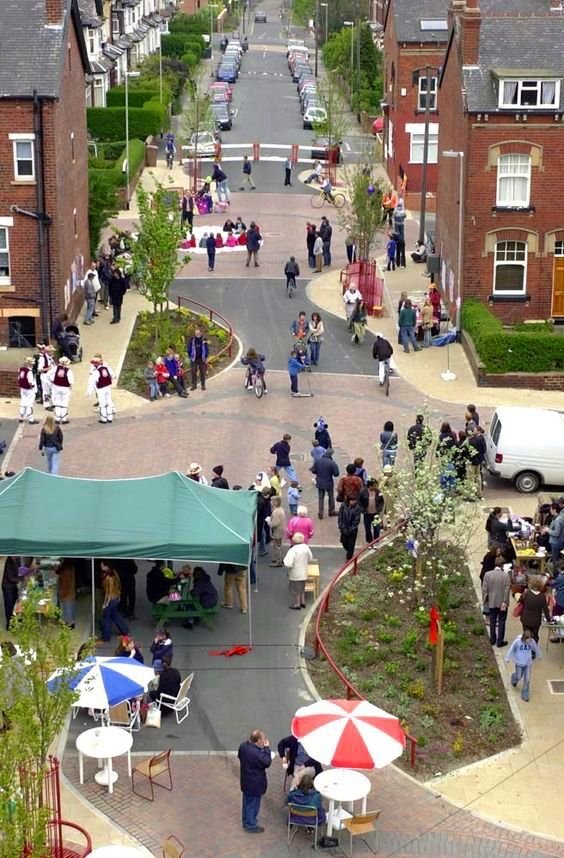
The Methleys Home Zone in Leeds
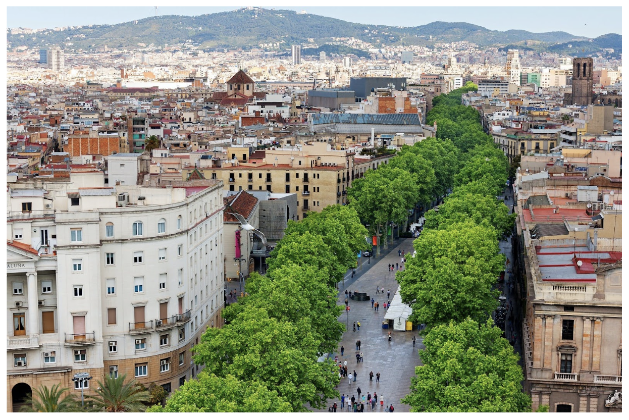
Barcelona, Spain
The use of golf carts and NEVs (Neighborhood Electric Vehicles) are rising throughout the country – from Palm Desert, California to Peachtree City, Georgia - as cities recognize that not everyone can drive a car, and a car isn’t always the best form of transportation for every trip.
Small electric vehicles fill the gap between a car and walking or biking, which may not work for transporting kids or bringing home groceries or bulky items, but a golf cart is more fun, easy and convenient than a car.
There are different types of small vehicles: golf carts, NEVs, and LEVs (Little Electric Vehicles) are all small electric vehicles designed for low-speed environments often with a maximum speed of 25 mph. They offer the option to save on gas and reduce climate emissions, and reduce the space needed for parking. For people who can’t drive due to a disability, age, or simply because they do not want to own a car, NEVs offer an alternative. According to AARP, Americans are living so much longer that we outlive our ability to drive a car by an average of 7-10 years. Long after we can drive, we can often still use golf carts, bikes, trikes and adaptive bikes. Low speed environments that are safe for Golf Carts are also safer and more inviting for walkers and bike riders of all ages and abilities.
Here is a Case Study of a NEV and Golf Cart Master Plan for the city of Lincoln, California.
NEVs & Golf Carts
6.
Traffic is a major concern for Angelenos, and it is possible to eliminate it through proven strategies. The real problem is a few hours every day when it’s peak travel time. It is possible to move enough trips to eliminate traffic. Key tools include:
Reducing the number of cars on the street during peak travel times
Offering high-quality mobility alternatives
Spreading trips out during off-peak hours so the number of cars on the road never exceeds the capacity
Reducing the number of cars: There are strategies to reduce the number of car trips and cars on the roads during peak travel times.
High quality alternatives
Deliveries are moved to nighttime and off-peak times
Parking Apps
Encouraging Carpooling through Bus-HOV lanes
High Quality alternatives: The LCI creates options to shift trips away from cars by creating reliable and safe alternatives. Half of trips in LA (and in most cities) are under three miles – a 15 minute walk or bike ride. Since people tend to opt into walking and biking over driving, if we create safe, pleasant, and reliable alternatives to cars people will use them: walkable streets with neighborhood serving retail, slow cars and trees; child-safe bike lanes, and a seamless connection to high-quality transit (fast, frequent and reliable). Slow streets that encourage golf carts and NEVs can also replace trips. Data shows up to 70% of trips will be non-car trips.
Deliveries at night: requiring deliveries at night can reduce traffic, and the time and cost of deliveries – saving millions.
Parking Apps: An estimated 30% of traffic can come from drivers circling the block looking for a parking spot, and Parking Apps can instantly make life better. Parking Apps are already being used around the world. This is how it works: a Parking App lists every open parking spot near your destination – street parking, municipal lots, and private parking lots and garages can be encouraged to add themselves. Sensors are installed on every spot using off-the-shelf tech, and tell drivers where the open spots are. Drivers can also pay suing the App, and it can automatically extend the time so drivers never get parking tickets (but they may pay a higher and higher fee, which is good for cities).
Parking Apps can also be paired with the concept of “pricing parking” – an idea championed by UCLA professor Donald Shoup, author of The High Price of Free Parking (whose work is so popular that he has his own Facebook fan group called Shoupistas, with thousands of members). Professor Shoup’s model shows that by charging the right price for parking, 20% of spots can be open all of the time, while a city like NYC could take in $3 billion per year. (Note: non-phone users can still pay for parking the analogue way).
Bus-HOV lanes: LA has a comprehensive bus system, and many routes are technically frequent – but in reality, buses get stuck in traffic, which makes the routes slow and unreliable. A simple, low-cost, overnight way to make a bus run on time is an orange-painted dedicated bus lane. In a dedicated bus lane, buses never get stuck in traffic and always run on time. The drawback is it is frustrating for drivers stuck in traffic to be sitting next to a bus lane that is empty except every 5-15 minutes for one bus. A fix can be to allow dedicated bus lanes to double as an HOV lane (High-Occupancy Vehicles) and allow carpools. Many schools require carpools to have 2-3 students per car and families quickly adjust. Carpooling can be a powerful tool to reduce the number of cars on the road.
More options in the Toolkit
Spreading trips out: Roads have limited capacity, but if we spread trips out over the course of the day, it is possible to eliminate congestion. One option that is politically challenging but highly effective is called Dynamic Pricing or variable pricing of roads. LA is already studying it for a few streets. Here is how it works: when a road fills up, drivers pay a fee to use the road, and the fee is dynamic and varies with demand. In the middle of the day or the middle of the night, when there is no traffic, the fee is zero. When it’s peak travel time, it floats with demand.
As a pilot program so people can experience the benefits of Dynamic Pricing, cities can create Bus-HOV-DP Lanes – a painted dedicated bus lane that is also an HOV lane, and any unused road capacity can be Dynamically Priced, allowing single-occupancy cars to use the lane for a fee that varies depending on the traffic. This way, the bus lane will be full during peak traffic hours, but will never overflow and slow down, so buses are always fast and on time. It also encourages people to carpool, and the city collects revenue. The revenue can be dedicated to improving transportation, or can also be given back to residents equally, or given back on a sliding scale, or to low income residents most impacted by the fees.
While Congestion Pricing (a flat fee to use the roads) reduces car trips substantially, it isn’t precise, while Dynamic Pricing is, and therefore also has an enormous impact on buses.
When paired with high-quality alternatives (and exemptions for low income workers, essential workers, ADA, doctors visits, etc.) it can nudge drivers to delay a trip to an off-peak time, carpool, walk, bike or take the bus. In this model, buses never get stuck in traffic (there is no traffic), and always run on time and get across town at the speed limit (ideally, 20 mph). This makes buses fast, frequent and reliable – the elements that make buses high-quality and therefore scale up.
Dynamic Pricing has been piloted in cities across the world and has been shown to effectively nudge drivers to spread trips out and eliminate traffic on the lane it applies to.
Traffic
7.
Cities and cars struggle to go together, especially if the cars are going fast. The speed of the cars determines the quality, safety and usability of the street. Fast cars make a street noisy, dangerous, and more polluted. Walking along a street where cars are going 50 miles an hour is essentially walking along a freeway, and it is uncomfortable and unpleasant. Fast cars also make it deadly and scary to bike.
But slow cars (or no cars) along a vibrant street pulls people in and creates what Jane Jacobs called a “sticky street” – a place you want to gather, meet friends, and linger. Slow cars and no car streets invite people to bike. The speed of the car determines the feeling of the street, and how we want to use the street.
Speed of Cars
8.
50 mph – commercial corridors – almost no one walks or bikes
20 mph and up with protected bike lanes – some walkability and bikeability.
15 mph and under - it will feel like Larchmont Boulevard which will see substantial walking, vibrancy, more biking (but still minimal)
Car-free streets like CicLAVia– widespread biking and walking. The street will be safe for children to bike unsupervised. Biking and walking will be relaxing and joyful, and the street will be an amenity for the entire community.

The key number for no fatalities is under 18 mph. There are two ways to enforce the speed: design and speed cameras.
Design: narrow lanes nudge cars to slow down, especially when there are also metal bollards (drivers worry they will ding their car). The wider the lanes the more we speed up as drivers. 12 ft lanes (the width of a freeway lane) invite drivers to speed up and a driver can comfortably go 50-70 mph. But 8 and 9 ft lanes (which exist all over the U.S. in older cities) force drivers to slow down. Speed Bumps, Speed Tables and Stop Signs slow cars down, but they often just speed up again. There are no generally accepted guidelines that tie the design of the street (width, speed bumps, etc) to the crucial under 18 mph goal.
Speed Cameras: Conversely, speed cameras are a highly effective method to slow cars to a precise goal. Speed cameras (aka Automatic Speed Enforcement or ASE) take a photo of your license when you speed by the camera. It is off-the-shelf tech that works all over the world. It also raises significant revenue for cities that can be used for other safety measures. Cameras are so effective, that cities find the fees drop by 75% after the first year because drivers simply slow down (which is the goal).
Speed cameras require a paradigm shift because speeding has been treated as a joke for decades, the same way drunk driving was treated – something funny and to be laughed at, not punished. A major social movement changed the paradigm – led by MADD – Mothers Against Drunk Driving, in what became a case study of effective advocacy. There is no inherent right to break the law, which speeding is. This is accepted when a cop pulls a driver over, which is highly problematic, costly and dangerous.
California passed a bill to allow a limited number of speed cameras to be piloted in six cities. There are limitations that prevent them from enforcing a speed of the crucial 18 mph: tickets that do not start until drivers are going at 11 mph over the speed limit (in a 35 mph zone, tickets start at 46 mph; a pedestrian who is hit at that speed would have almost no chance of surviving). The tickets are also low ($50.) Cities also cannot set their speed limits.
The LCI advocates for cities to have local control over their own speed limits and the use of speed cameras – where, and at what speed over the speed limit a ticket is issued (jurisdictions like Bishop, CA ticket drivers one mile over the speed limit). Privacy rights advocates argue against speed cameras, saying that streets can be made safe through design, but there is no evidence or data on that claim.